Terra Draw - Bring drawing feature to all map applications
What is Terra Draw
An introduction for newcomers
Drawing on a web map looks simple
Until you have to build it.
- Click to add a vertex, drag to move it, snap it to its neighbour
- Keep the geometry valid while the user is still drawing
- Undo, redo, select, delete
- Then do it all again on the next mapping library
Every map library had its own answer
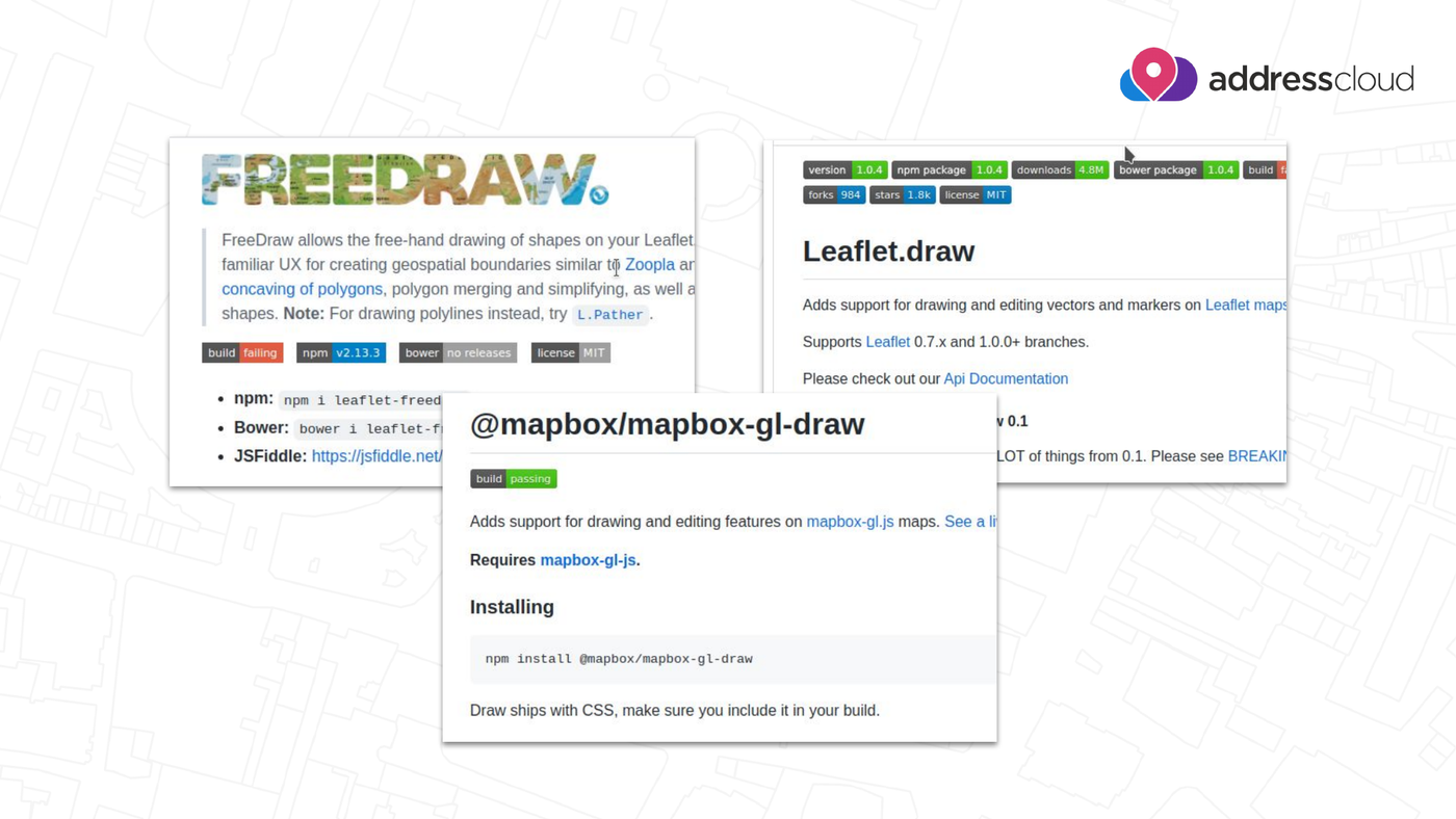
Leaflet.draw, leaflet-freedraw, mapbox-gl-draw... different APIs, different behaviour, different bugs — and your drawing code is locked to one map.
Terra Draw
An open source TypeScript library for drawing on web maps, created by James Milner about four years ago.
One drawing engine, many maps.
Goals
- Cross map library support
- Custom modes
- Deep styling control
- Zero dependencies
How it fits together
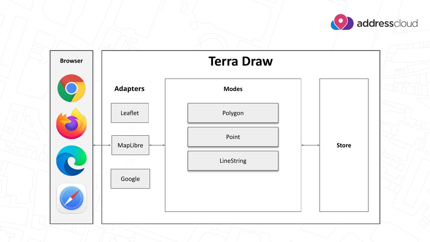
Adapter talks to the map · Modes own the interaction · Store holds the GeoJSON.
One API, many maps
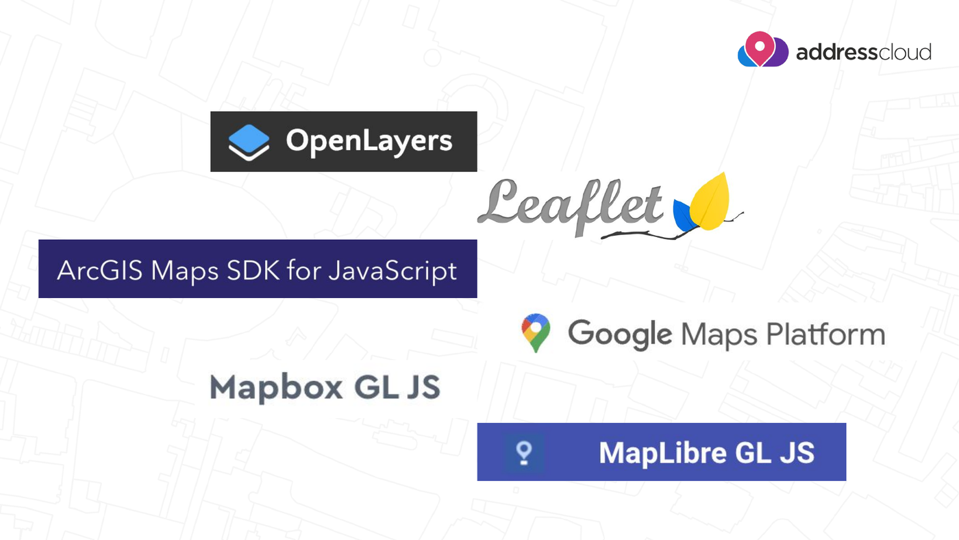
Swap the adapter, keep everything else.
Modes do the drawing
point,linestring,polygon,marker,polylinerectangle,angled-rectangle,circle,sector,sensorfreehand,freehand-linestringselect— move, rotate, scale, delete- ...or write your own
Getting Started
What does TerraDraw help you achieve?
Set up in a few lines
import { TerraDraw, TerraDrawPolygonMode } from 'terra-draw';
import { TerraDrawMapLibreGLAdapter } from 'terra-draw-maplibre-gl-adapter';

const draw = new TerraDraw({
  adapter: new TerraDrawMapLibreGLAdapter({ map }),
  modes: [new TerraDrawPolygonMode({ snapping: true })]
});

draw.start();
draw.setMode('polygon');
The data is just GeoJSON
draw.on('finish', (id) => {
  const snapshot = draw.getSnapshot();
  const feature = snapshot.find((f) => f.id === id);
  console.log(JSON.stringify(feature));
});
getSnapshot() / addFeatures() — load, save and round-trip your features
with anything that speaks GeoJSON.
What's new for 2026?
New features to use in your project
Undo / redo
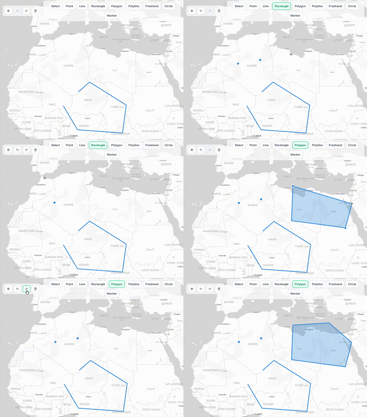
Common in every drawing application, one of the most requested features — and hard to get right.
A two-part system
- Drawing undo / redo, which works inside a single mode
- Session undo / redo, which works across modes
- Use them together, or either one on its own
Styling improvements
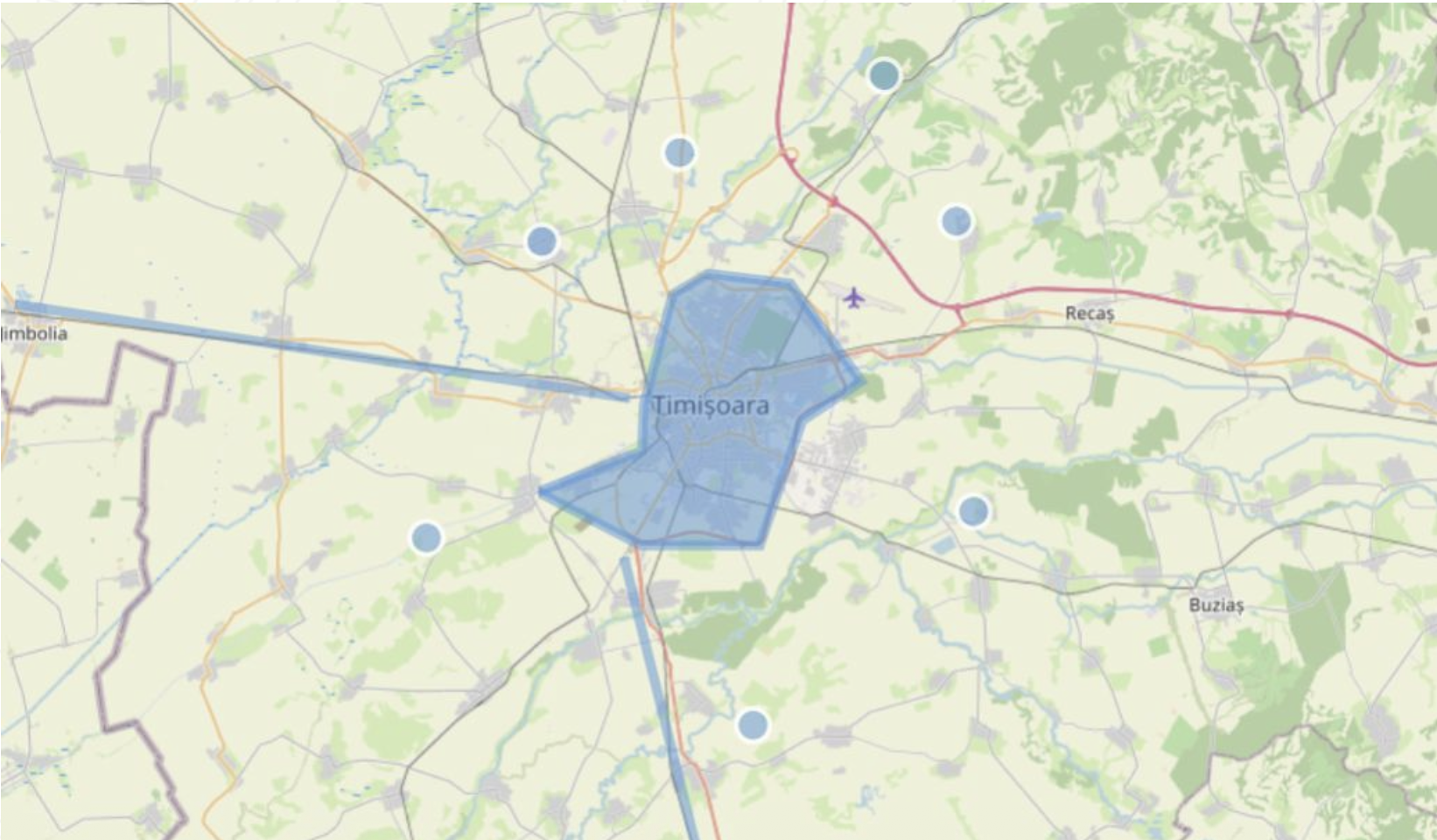
New ways to style your geometries — style callbacks receive the feature, so colour, width and opacity can depend on your own properties.
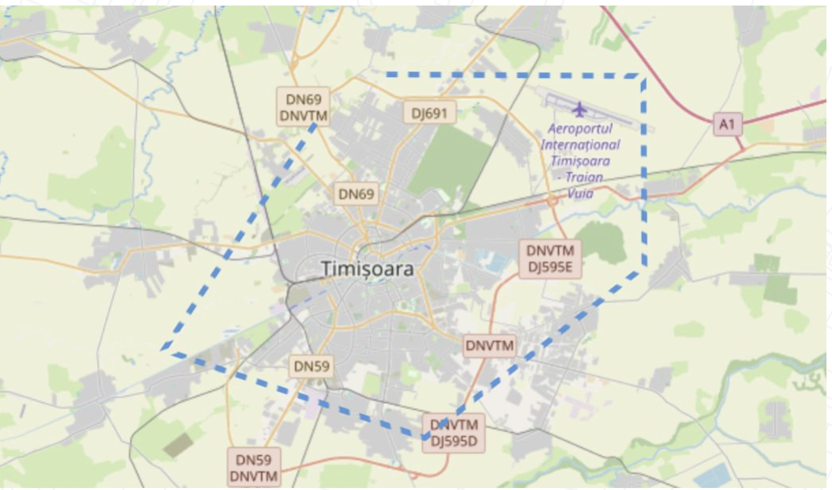
line mode now supports dashed lines, with a new lineStringDash style property.
Polyline mode
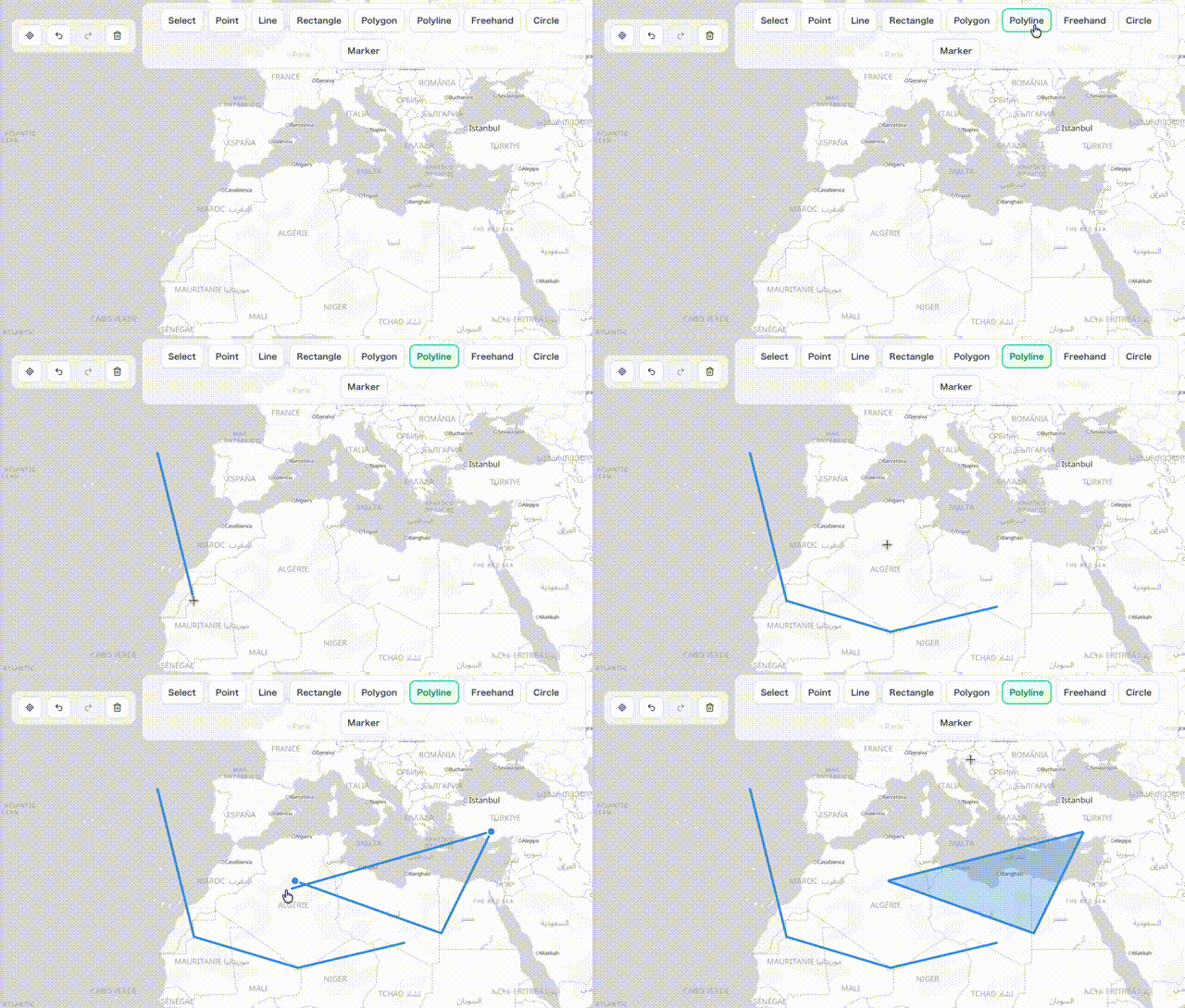
Lines that can be closed into polygons: start drawing a line and finish it as an area, without switching mode.
Multiple instances of the same mode
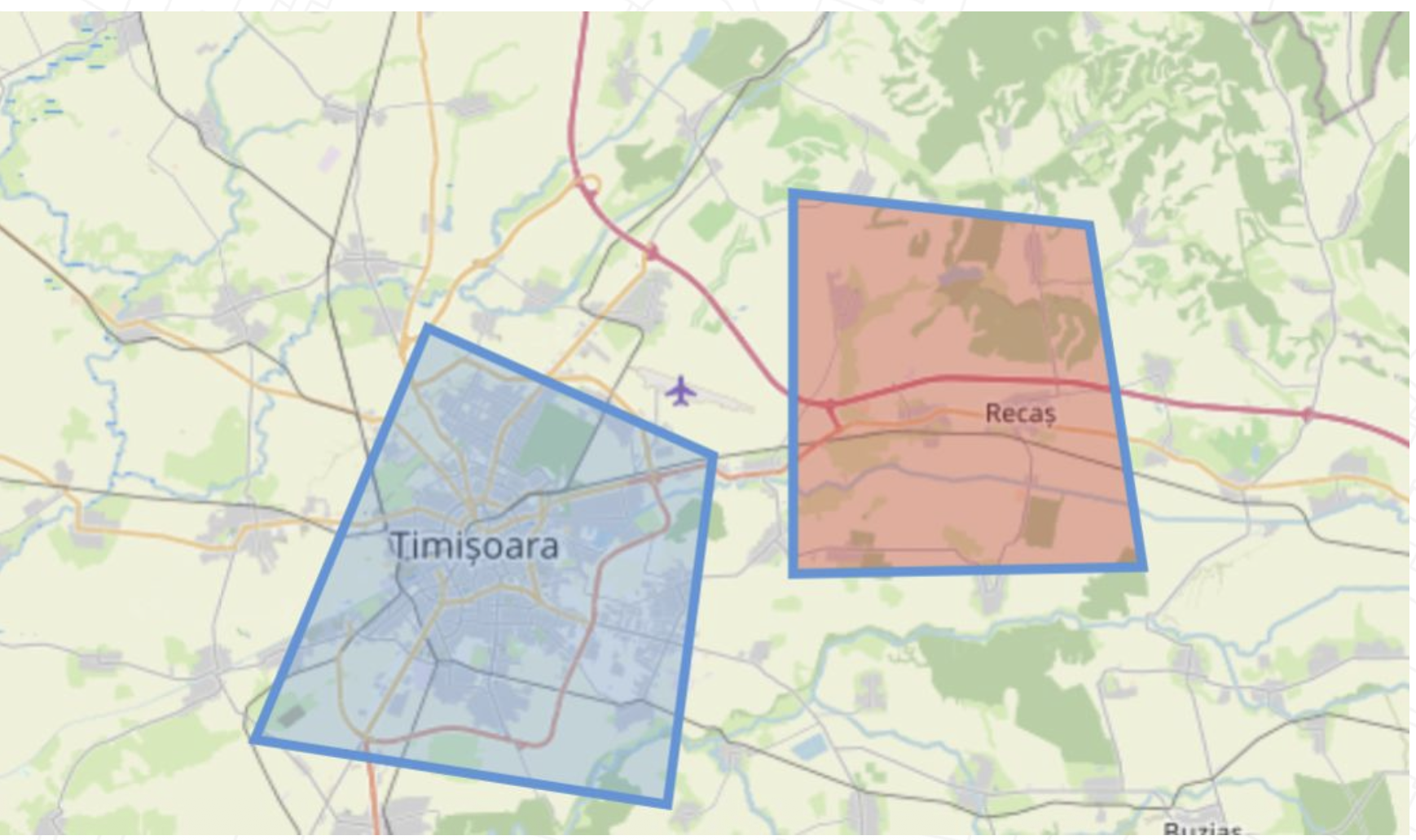
Register one mode twice with different configurations — for example two polygon modes with different styling and validation.
New drawing interactions
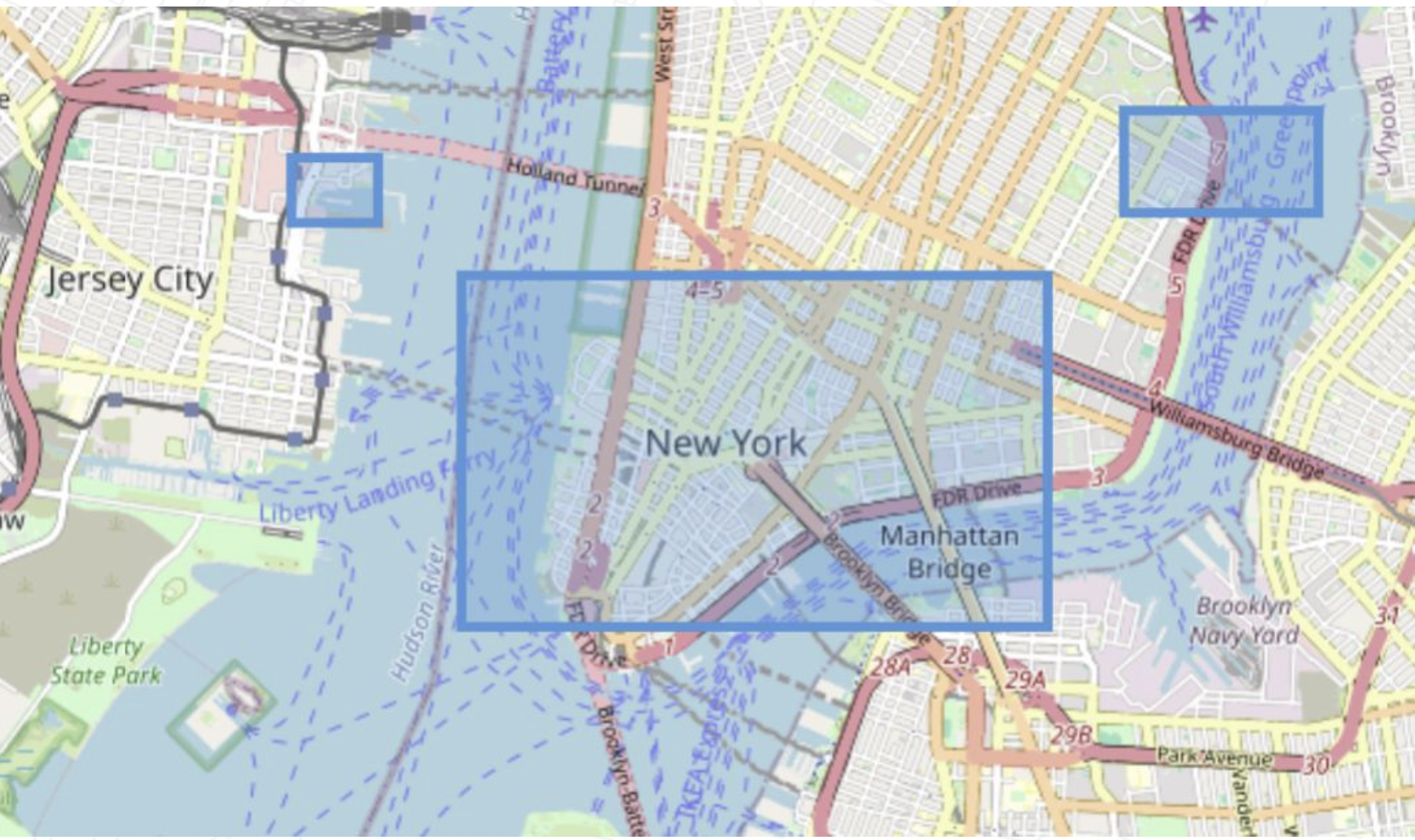
Click and drag support: drag out a rectangle or a circle in one gesture instead of clicking corner by corner.
But you still have to build the UI
Terra Draw gives you the drawing engine — the buttons, the mode switching and the map controls are yours to write.
maplibre-gl-terradraw
A MapLibre GL JS plugin: Terra Draw plus a ready-made control.
One line to add the control
Then, just one line of code to add the control to your MapLibre map:
import { MaplibreTerradrawControl } from '@watergis/maplibre-gl-terradraw';

map.addControl(
  new MaplibreTerradrawControl({ open: true }),
  'top-left'
);
Measure control
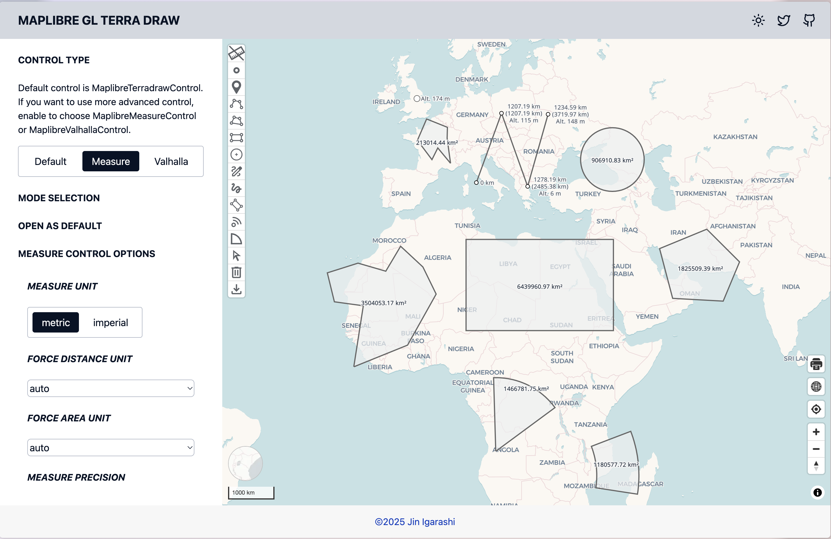
MaplibreMeasureControl adds distance and area labels to the geometries as
you draw them.
Routing with the Valhalla control
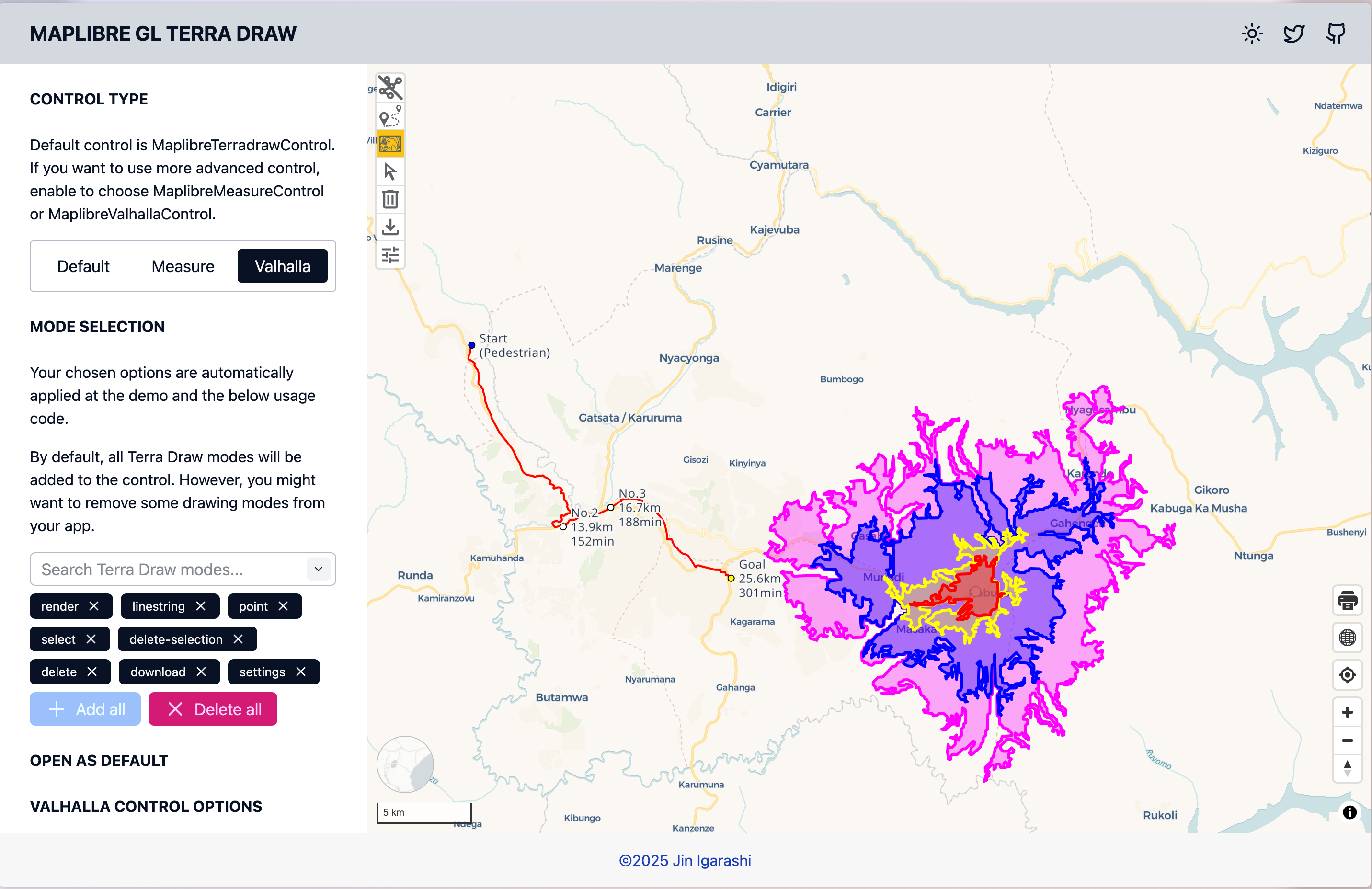
Draw a line, get a route back — the isochrone and routing controls turn drawn geometry into an API request.
An example - UNDP's GeoHub
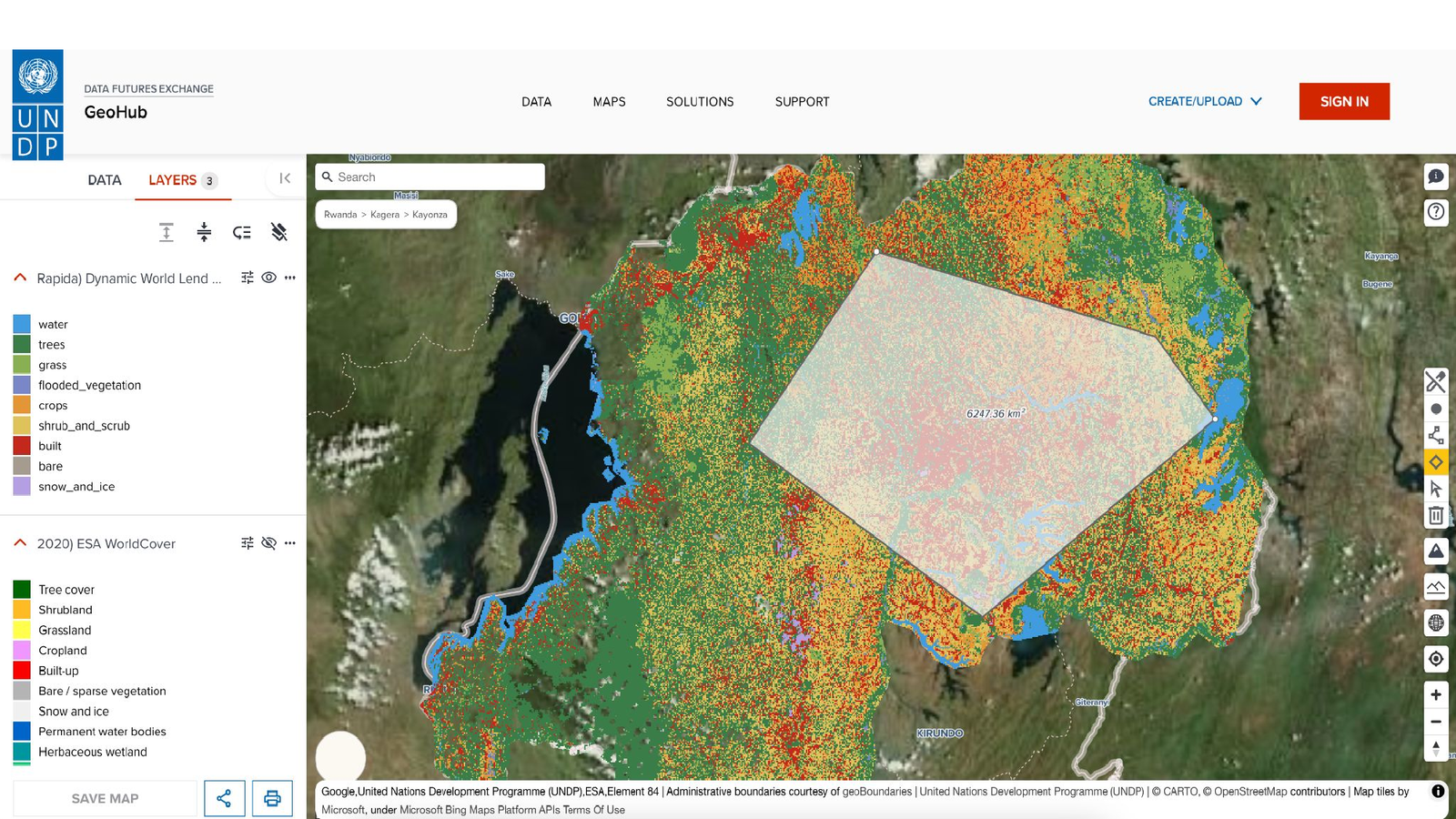
UNDP's GeoHub uses the plugin for drawing and measuring.
Contribution
How you can get involved with the Terra Draw project
Contributing
- Lend a star on GitHub
- If you find a bug, post a clear reproducible issue
- Discuss issues on the tracker, and raise pull requests
- Let's chat after the talk if you are interested!
Links and resources
- Terra Draw — terradraw.io · JamesLMilner/terra-draw
- Plugin — terradraw.water-gis.com
- Workshop material - workshops.terradraw.water-gis.com
Try it yourself
The FOSS4G 2026 workshop runs through all of this in the browser, with a live editor on every page:
Terra Draw workshop - workshops.terradraw.water-gis.com/workshops/foss4g2026/
No install, no build step — edit the code and the map updates.
Questions?
Thank you for listening